Thank you for joining our community of citizen scientists, researchers, and wildlife enthusiasts. Croc Watch empowers you to log and monitor crocodile sightings across India — from a single crocodile basking by a river to multi-day GPS field surveys. The data you collect helps protect and understand these incredible reptiles.
Key Terminology
- Sighting
- A single observation of a crocodile (or group) at a specific pin on the map.
- Submission
- Your complete field report. One submission can contain multiple sightings, a GPS survey track, and team collaborators.
Croc Watch is available for Android and iOS. Download it from the Play Store or App Store and open the app.
Creating Your Account
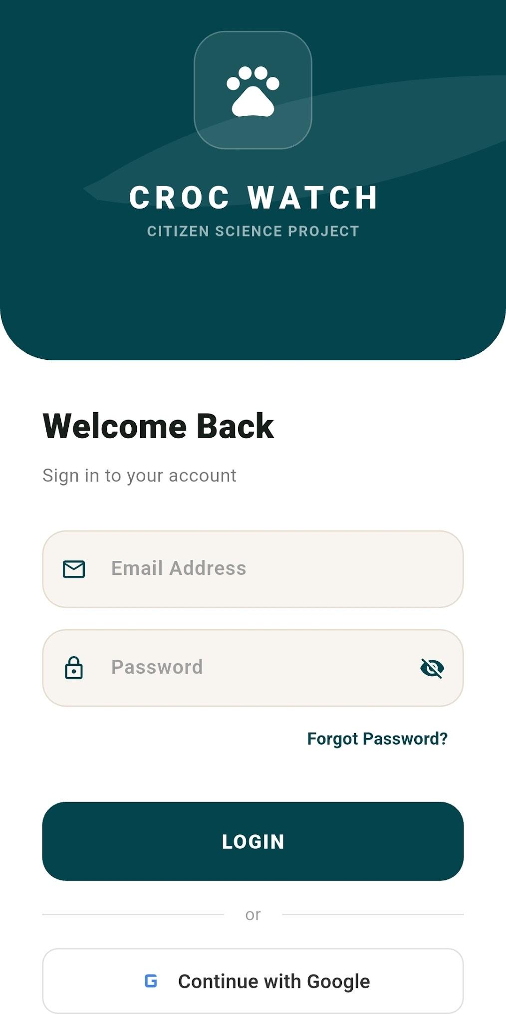
1 Tap Register on the login screen. 2 Enter your Full Name, Email, and a secure Password. 3 Tap Register to submit. 4 Check your inbox for a verification email and tap the link to activate your account.
Android shortcut: Tap Continue with Google for instant access — no form needed.
Forgot your password? Tap Forgot Password, enter your email, and a reset link will be sent to your inbox.
After your first login, you will be prompted to complete your profile. These fields are optional but add credibility to your sightings as a citizen scientist.
You can provide:
- Phone Number, Gender, Date of Birth
- City, State, Country
- Organization (ideal for NGOs and Forest Department staff)
- A brief Bio and Social Media handles
You can skip this step and update your profile at any time via the drawer menu → Profile.
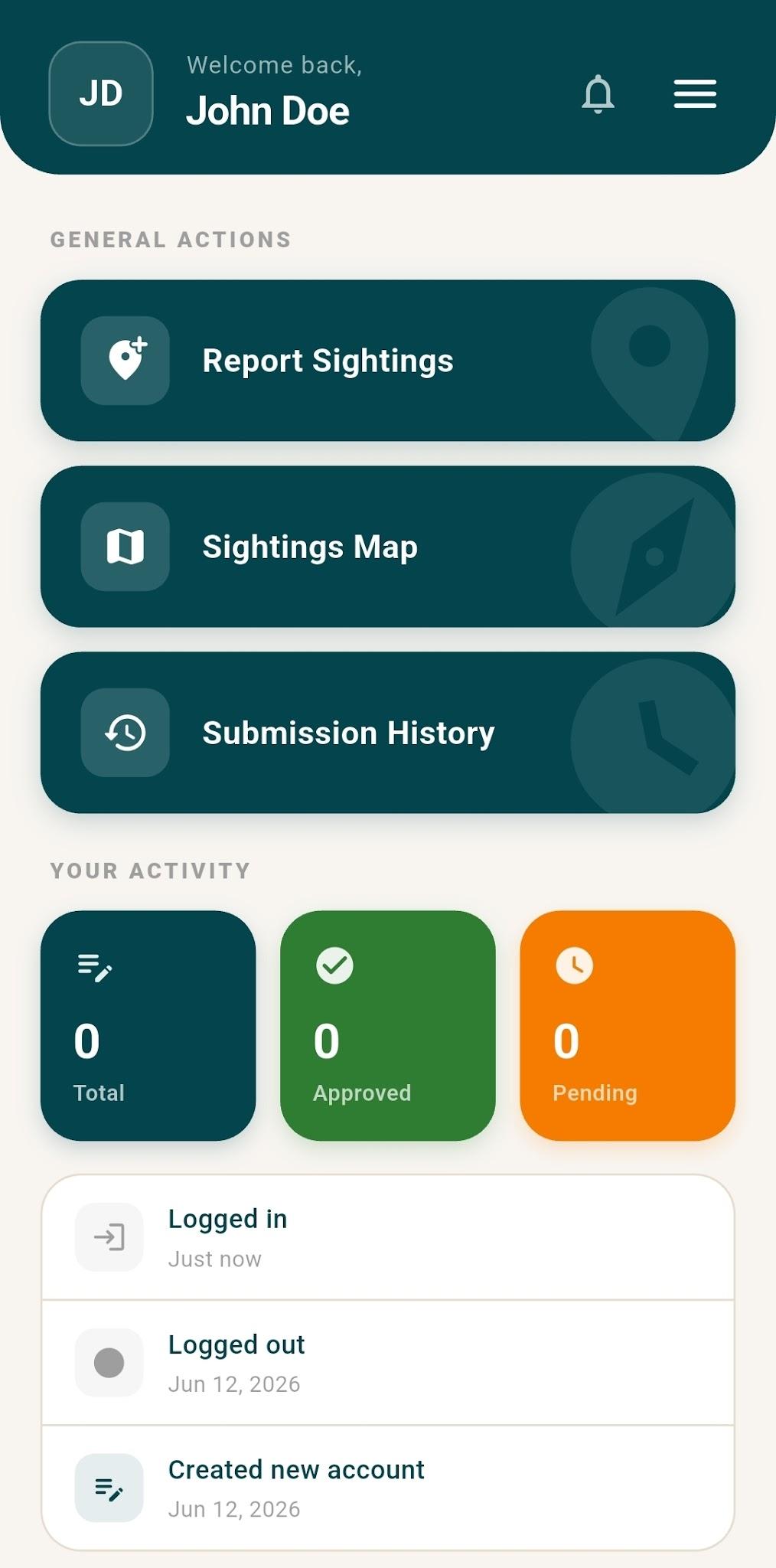
Your Dashboard is your central command hub. From here you can reach everything in the app.
- Your Activity — Total, Approved, and Pending submission counts at a glance.
- Quick Actions — Buttons to Report Sightings, view the Sightings Map, or check Submission History.
- Recent Activity — A timeline of your last 5 actions.
- Management Section — Only visible to Admins and Reviewers.
The Drawer Menu
Swipe right or tap (≡) to access your Profile, Notifications, App Settings, and Submit Feedback.
Header Icons
- Bell icon — View notifications (approvals, rejections, clarifications).
- Cloud icon — A red badge indicates offline submissions waiting to sync. Tap to upload them immediately.
This is the core feature of Croc Watch. Follow these steps to log an observation.
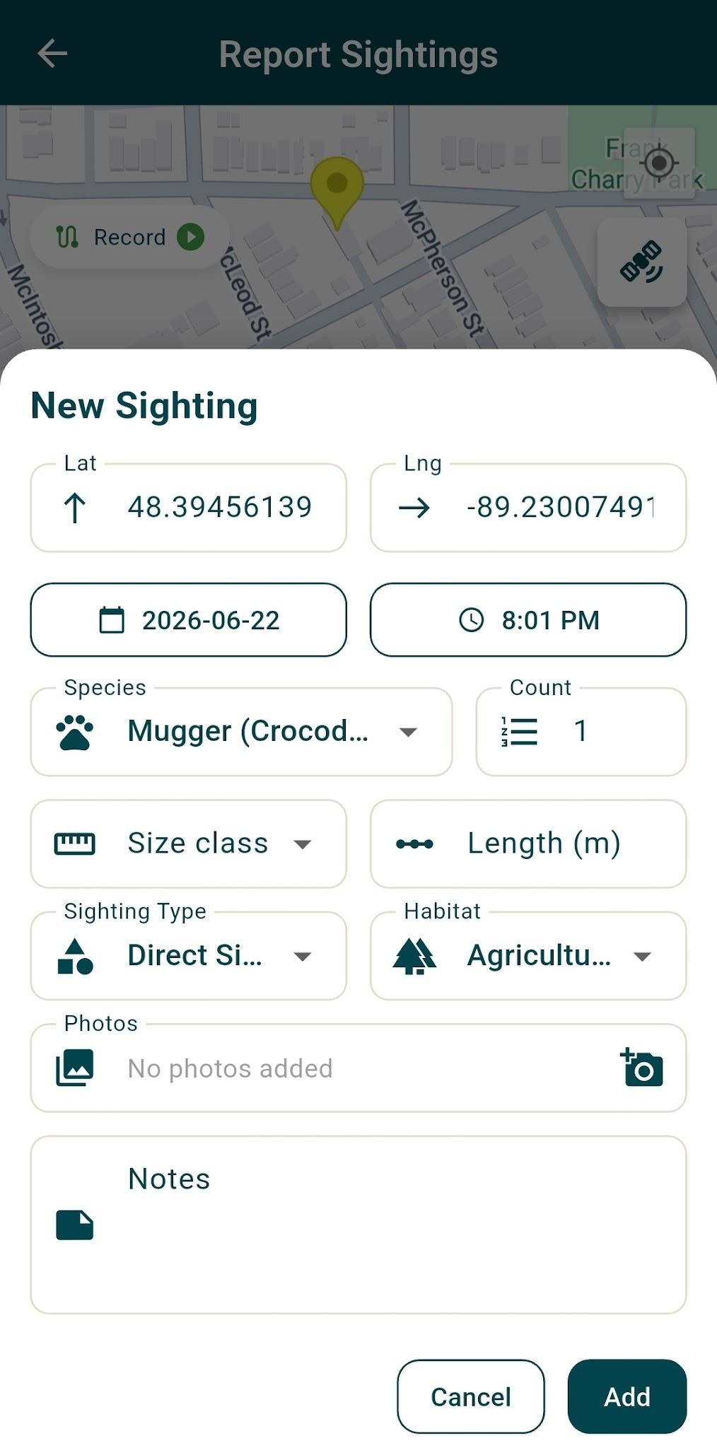
1 Open the Map — Tap Report Sightings on the dashboard. A full-screen map opens centred on your location. 2 Drop a Pin — Tap anywhere on the map to mark the exact location. A form slides up from the bottom. 3 Log Sighting Details — Fill in the observation form (see fields below). 4 Add Photos & Notes — Tap the camera icon to attach photos. Use the Field Notes box for weather or behaviour observations. 5 Save — Tap Add. The map marker turns from red to green, confirming it is saved to your submission.
Pro Tip: Photos clearly showing the snout and neck scutes greatly help our review team confirm species!
Sighting Form Fields
Species Mugger, Saltwater, Gharial, Unknown Count & Size Class Number of crocs; Hatchling → Adult Sighting Type Direct, Camera Trap, Tracks/Signs, Nest, etc. Habitat River, Mangrove, Dam, Road, and 24 more Activity Observed Basking, Swimming, Nesting, etc. Date & Time Adjust if logging a past sighting
Adding Multiple Sightings
You do not need a new submission for every crocodile on a single trip. After saving your first sighting, tap the map again at a new location, fill in the details, and repeat. All sightings group into one Submission.
Recording a GPS Track
Document your walking, boating, or driving route to record your survey effort.
1 Tap the Play button in the floating pill at the top of the map. 2 A timer starts. Your path is drawn as a green line on the map in real-time with elapsed time and distance shown. 3 Use Pause / Play as needed — your accumulated path is preserved. 4 Tap Stop when done. The track turns teal when saved, with the total distance shown.
Battery saving: The app uses a 10-metre distance filter to avoid overlapping lines when stationary and to conserve battery life. Total distance is calculated automatically.
Surveying with colleagues? Tag them so everyone gets credit for the data collected.
1 On the map screen, tap the Collaborator icon (person with +) in the action row. 2 Enter the email address of your team member — they must have an active Croc Watch account. 3 The app verifies the user. You can add up to 5 collaborators per submission.
Once approved, the submission will appear in everyone's Submission History automatically.
Once you finish adding sightings and recording your track, decide what to do with your data.
Save as Draft
Stores data locally on your phone. Great when you are still in the field and want to add more sightings later.
Submit for Review
Sends your data to the VNC team. Status changes to Pending while reviewers evaluate it.
Privacy Toggle
Before submitting, use the app bar toggle to mark your submission as Private (you + admins only) or Public (shown on the map when approved).
Croc Watch is built for the field. You can log data even with zero network coverage.
- When offline, the interactive map is replaced with a GPS location selector.
- Tap Get Current GPS Position to use your phone's satellite, or enter coordinates manually.
- Your data is safely saved to your phone in local storage.
- Back in range? A cloud upload icon with a red badge appears on your Dashboard. Tap it to upload all offline drafts at once.
GPS still works offline! You can record a full survey track without mobile data — satellite positioning is independent of network coverage.
Tap Submission History on the dashboard to track your contributions. Use the tabs to navigate:
✓ Approved
⏳ Pending
📝 Drafts
💬 Needs Clarification
- Approved — Your sightings are live on the public Sightings Map.
- Pending — Awaiting evaluation by our moderators.
- Drafts — Saved locally. Submit whenever you are ready.
- Needs Clarification — A reviewer has a question (e.g. "Can you upload a clearer photo?"). You will be notified.
Tap any submission card to see the full map, GPS track distance, collaborator list, and complete review history. If a submission needs clarification or is rejected, you can edit the details and resubmit from this screen.
Tap Sightings Map to explore the community's work. This full-screen interactive map shows all approved, public crocodile sightings across India.
- Toggle between My Sightings and All Sightings using the header control.
- Tap the Filter icon (bottom-right) to open a filter sheet — search by Species, Habitat, or Sighting Type.
- Active filters appear as dismissible chips below the header. Tap × on any chip to remove it.
- Tap any map marker to view an info card with species, count, habitat, and location details.
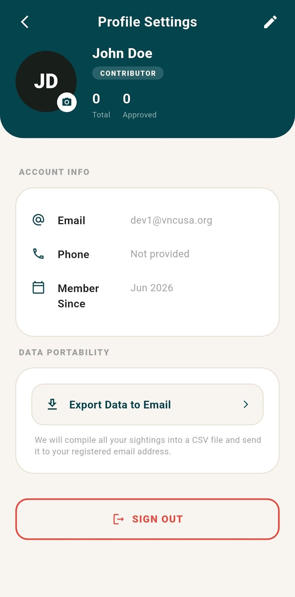
- Export Your Data — Navigate to Profile Settings → Export Data to Email. A CSV of all your approved sightings will be sent to your registered address.
- Notifications — Tap the Bell icon on the dashboard to see status updates on your submissions.
- Submit Feedback — Open the drawer menu and tap Submit Feedback to message the development team directly.
Croc Watch uses a tiered system to ensure data accuracy and accountability.
Contributor
Default role. Report sightings, record GPS tracks, view the public map, and export your personal data.
Reviewer / Moderator
Access the Review Center. Approve, reject, request clarification, edit sighting details, and leave internal notes on submissions from all users.
Admin
Full system access. Manage user roles, view system-wide activity history, and override any submission status.
| Sighting Type | When to Use |
|---|
| Direct Sighting | You observed the live crocodile with your own eyes. |
| Camera Trap / Drone | Captured via remote camera or aerial footage. |
| Tracks / Signs | Found footprints, slide marks, or scat — no direct animal observation. |
| Active Burrow / Nest / Eggs | Evidence of habitation or active breeding. |
| Dead / Roadkill | Found a deceased crocodile. |
| Conflict / Rescue | Involved in a human-wildlife conflict or official translocation event. |
| Community Report | Reported to you by a local — not directly observed by you. |
Habitat Types
Croc Watch features 28 specific habitat types to accurately reflect India's diverse ecosystems — from upstream rivers and coastal mangroves to agricultural ponds and urban waterbodies. Always choose the most accurate option available.
|